(
(Gis2Cad
The most popular GIS functions directly in your favourite CAD platform!
Gis2Cad is the only software on the market that combines the essential functions of the popular GIS applications, such as QGIS and Spatial Manager, with the tools improving surveyors and designers works.
Buy Gis2Cad
Buy a license and start using the program today!
Choose the variant that suits your needs:
Stationary licenses

(1 seat)
period:annual
(1 seat)
period:perpetual
Remote licenses
(USB remote)
period:annual
(USB remote)
period:perpetual
Update and support
(USB remote)
(1 seat)
period:annual
Buy a license and start using the program today! Choose the variant suitable for your needs! A single-station license will allow you to use the program on one device, while a portable (USB) license will allow you to work with the program on multiple stations (devices). Effectively adjust your purchase to the expected duration of program use with one of the additional options (perpetual and temporary keys). Learn more about the licenses.
Gis2Cad
0,00 $
Selected product
Gis2Cad
Total
0,00 $
Available payment methods

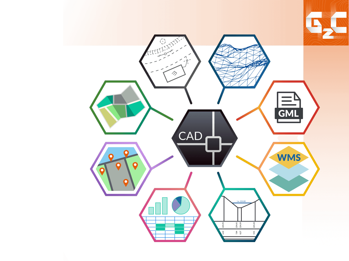
Features of the program
- Interactive connection of a CAD file with an EXCEL sheet
Making map analyzes of spatial data in connection with a spreadsheet database, - Creating lists of map objects according to given parameters (area, line, object, etc.),
- Analysing and editing attribute data of map objects,
- Creating lists of land utility networks from the map,
- Generating terrain balances,
- Creating a list of coordinates of selected CAD drawing objects,
- Performing analyzes on sets of coordinatesBased on spatial criteria (scope, distance, cadastral data, etc.),
- Processing sets of coordinates
Transformation between systems, translating, averaging, removing duplicates, filtering, renumbering, etc. - Inserting coordinate sets into a CAD drawing
In the form of points, texts, symbols
- Georeference (calibration) of raster files
Matching raster images by indicating identical elements in a CAD drawing, - Inserting georeferenced raster files into CAD,
- Editing raster filesDenoising, inversion, cropping, editing in an external editor (e.g. Paint), etc.
- Combining raster filesFor example, tiles downloaded from WMS/WMTS services,
- Raster file management
- Inserting online map images into CAD (local and global)
Downloaded map fragments are inserted into CAD in the form of raster images (tiles) and saved on disk - Displaying geospatial data from WFS services
Descriptive data from the land and building records, address data, statistical data, etc. - Has the extensive list of predefined WMS/WMTS/WFS servicesData from Google Maps, OpenStreetMap, thematic maps, etc.
- Possibile to easily add any websites using the wizard
- Creating digital terrain models (DTM)
Based on sets of coordinates, elements from the map, - Downloading DTM from geoportal.gov.pl,
- DMT import from files in LandXML, Esri grid formats,
- Use of DTM when developing profiles and cross-sections,
- Calculations of the volume of earth masses
- Generating profiles and cross-sections based on XYH, 3D models, data from geoportal.pl,
- Convenient data acquisition for cross-sections from a CAD drawing,
- A number of tools to automate the acquisition of data for cross-sections
Searching for points along the section line, interpolating ordinates, translating heights, - Automatic generation of cross-section drawing sheets in CAD with descriptions
- Many tools to automate map editing
Flattening a drawing, spreading texts, changing an arc to a polyline, cropping a map, etc. - Map transformation between coordinate and height systems,
- Automatic drawing of routes with descriptions,
- Plotting buffers
Import:
- Maps
GML, ESRI Shapefile, GeoJSON - Digital terrain model (3D model)
LandXML, ESRI Grid - Sets of coordinates
txt, csv, GPX, GeoJSON, TDS Raw (raw, rw5), Leica GSI, Sokkia SDR, SurvCE (crd), N-GEO (png), EWMAPA (punkty.dat), GEO89 (p89), WinKalk (points.db), C-GEO (db, cgo), GeoKalk (geo.mdb) - Raster images
RGB, Targa, Tag Image File Format, Apple PICT, PCX, Compuserve GIF, Windows BMP, Sun Raster, Img, Image RGB, RLE, FLI Animation Format, COT, JPEG, CIT, TG4, Cals Type 1 CCITT4, RLC, Portable Natwork Graphics, GEOTIFF, Bentley HMR, Internet TIFF, C29, MrSID, ERMapper Compressed Wavelets, Ingr. TIFF, MultiChannel, C30, C31
Eksport:
- Maps
GML, ESRI Shapefile, GeoJSON, Google Earth KML - Sets of coordinates
txt, Google Earth KML, GeoJSON, Leica GSI, GPX, GEO2000, M-GEO (Workabout), Geodimetr, Sokkia SDR, Garmin PCX5, Ozi Explorer WPT, Fugawi - Raster images
RGB, Targa, Tag Image File Format, Apple PICT, PCX, Compuserve GIF, Windows BMP, Sun Raster, Img, Image RGB, RLE, COT, JPEG, CIT, TG4, Cals Type 1 CCITT4, Portable Natwork Graphics, GEOTIFF, Bentley HMR, Internet TIFF, C29, ERMapper Compressed Wavelets, Ingr. TIFF, JPEG2000, RGB Compressed, CRL, Anatech LRD, Wireless BitMap, Erdas IMG, Internet TiFF64
- IntelliCAD and derivatives
From version 6, including: BricsCAD, ZwCAD+, GStarCAD, progeCAD, ActCAD and others. - Bentley MicroStation
95, SE, v7/J, v8, v8 2004 Edition, XM, v8i, Connect Edition and derivative versions: PowerDraft, PowerMap, GeoOutlook, Redline, Navigator. Version v8 2004 or later is recommended.
For ‘truncated’ versions such as Redline, Navigator, there may be some limitations in functionality. Versions older than v8 do not allow plotting of object maps. - Autodesk, AutoCAD
From version 2000 to the latest, AutoCAD LT – only with LT Extender or Cadsta Max. - ARES Commander
Ares Standard, Ares Commander from version 2018
Try for free!
14-day trial period