28/08/2023
Make surveying easier with GeoView (part 1)
|
GeoView – surveying software to work with coordinates in practice
How to deal with many coordinates? How to quickly preview them in a CAD drawing or check in Google Earth? How to search duplicates of measured points comfortably? The answer is simple! Use GeoView – the surveying software to work with coordinates created by Cubic Orb. GeoView is easy but powerful software for surveyors and not only. It serves also as the useful application for designers and construction specialists. In this article we describe some of its numerous practical applications.Loading coordinates regardless of their format
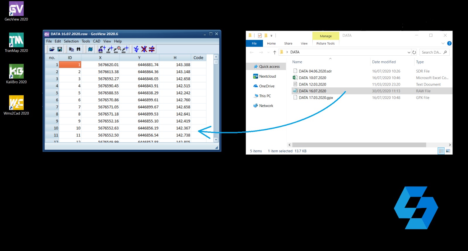 Operations on coordinates are an integral part of surveying. How can you load them comfortably? Just use GeoView which can do so by only one click! A file’s format doesn’t matter. GeoView deals not only with .txt and .csv files. Formats like Leica GSI, Carlson CRD, GPX, RAW, RW5 are supported too. The software can also read coordinates form EXIF metadata of JPG. What’s more GeoView automatically recognizes the coordinate format and correctly add the data to the table.
Processing a set of points
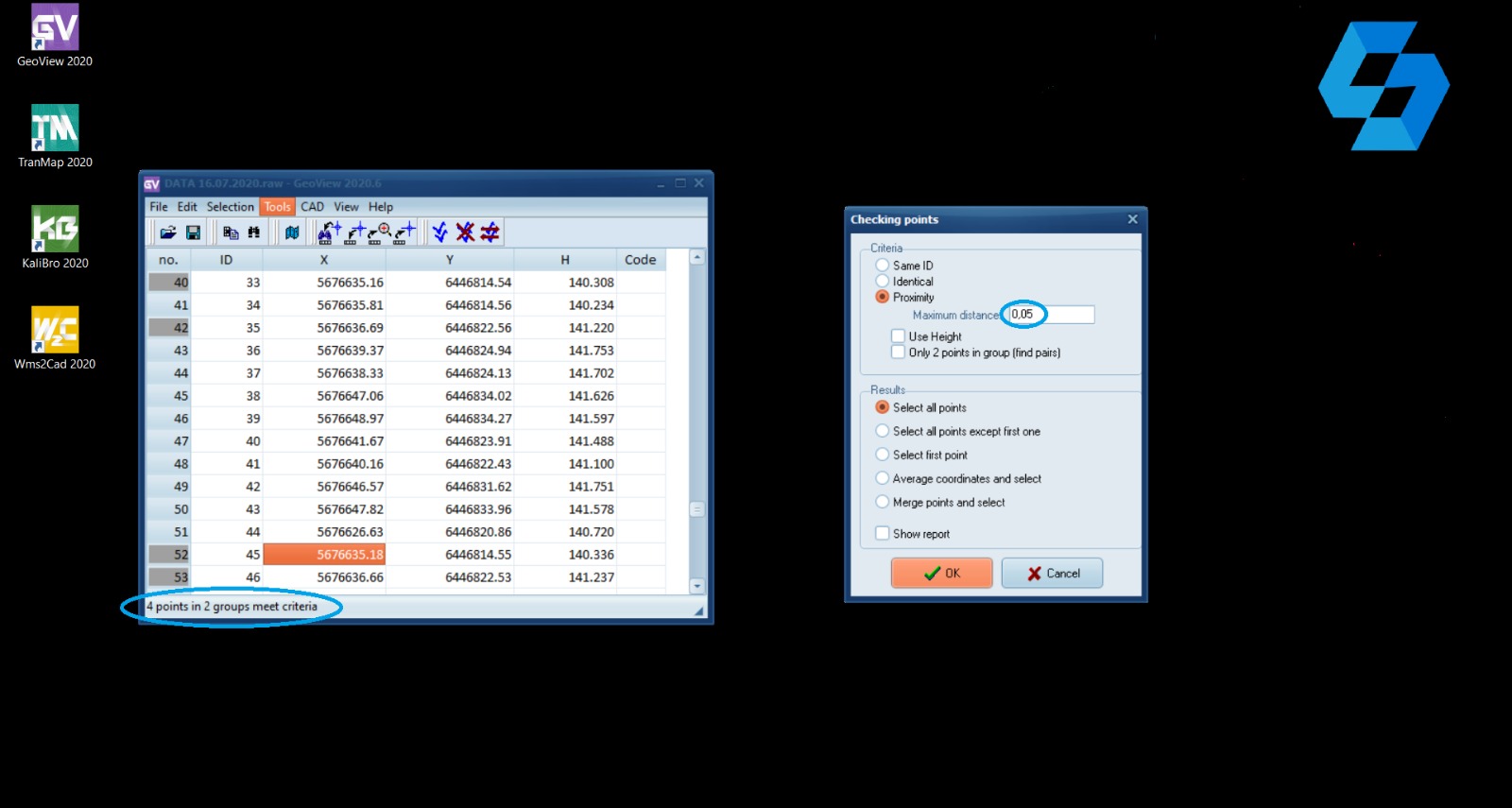 More and more surveying works are made with the support of drones or laser scanners which create point clouds. Even more frequently measurements last several months and are done by various people (sometimes subcontractors) with various surveying equipment. In situations like that you may need to:
- renumber a part of points,
- verify if the coordinates or point numbers aren’t duplicated,
- control if some elements weren’t measured two times
- change the height of points by a specified value.
In short there is the need of advanced processing of coordinates.
GeoView handles with such tasks thanks to functions of shifting, renumbering, translating and sorting. You can also revert columns’ sequence (X, Y, Z, Code) or work only on a part of selected coordinates.
More and more surveying works are made with the support of drones or laser scanners which create point clouds. Even more frequently measurements last several months and are done by various people (sometimes subcontractors) with various surveying equipment. In situations like that you may need to:
- renumber a part of points,
- verify if the coordinates or point numbers aren’t duplicated,
- control if some elements weren’t measured two times
- change the height of points by a specified value.
In short there is the need of advanced processing of coordinates.
GeoView handles with such tasks thanks to functions of shifting, renumbering, translating and sorting. You can also revert columns’ sequence (X, Y, Z, Code) or work only on a part of selected coordinates.
Use Google Earth and other background maps
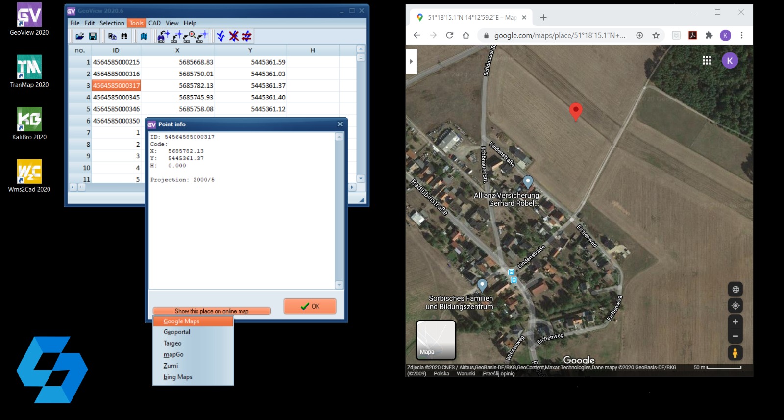 Do you want to quickly check where are the points but you don’t have a map background? GeoView will help you! Just choose Tools -> Show points in Google Earth. Do you have a map but would like to prepare to measurement and check a specific place in an orthophoto? Use GeoView and check the position of the point in Google Maps or bing Maps. If you save the point as a pin, you will easily reach a place of measurement.
It’s only a small part of our app’s capabilities. GeoView is a surveying software with by far more practical applications. In the next article we describe further useful functions, among others how GeoView works as a CAD plugin for surveyors and designers.
Do you want to quickly check where are the points but you don’t have a map background? GeoView will help you! Just choose Tools -> Show points in Google Earth. Do you have a map but would like to prepare to measurement and check a specific place in an orthophoto? Use GeoView and check the position of the point in Google Maps or bing Maps. If you save the point as a pin, you will easily reach a place of measurement.
It’s only a small part of our app’s capabilities. GeoView is a surveying software with by far more practical applications. In the next article we describe further useful functions, among others how GeoView works as a CAD plugin for surveyors and designers.